Monday, February 15, 2010

Pecos, Texas

Pecos, Texas

Weather: low 24 degrees in Alpine, high 48 degrees in Pecos, clear skies

Brrrr, it was cold this morning! The faucet froze because I forgot to cover it up last night. Using a hair dryer, it only took a couple of minutes to thaw it out.

I wrote in an earlier post that we had a tire on the RV that had a slow leak. Well, while we were parked in Alpine, the leak got worse. I made it down to a tire store, where the tire was removed, checked out, and repaired. It seems we had picked up a nail in our travels. I was more than happy to pay what was charged for the repair.

Leaving the tire store, we took Texas 67 north to I-10, where we picked up an FM road north to US 285, which took us into Pecos. We're staying in the Escapees RV park while we're here. We were parked and set up by 1230 hours.

After I rested a few minutes, I went into Pecos to check out the town. This is a town of about 9,500 people, located in west Texas on the high desert. The terrain is flat and rocky here, with scattered mesquite and creosote bushes. Dry, dry, dry.

Now, don't get me wrong. Even though it is dry here, the area produces some of the best cantaloupes in the world, the famous Pecos cantaloupes. We can say from personal experience that they are good. In addition, the area grows onions and cotton.

This is a picture of the Reeves County Courthouse. The architecture is a combination of Classical Revival and Mediterranean. This is the second courthouse, and was completed in 1937. Unfortunately, this is the best picture I could get because of the trees. That's kind of funny, since there are not that many trees here.

Continuing on with my tour of the town, the next stop was at a replica of Judge Roy Bean's Saloon and courtroom. Judge Bean was considered to be the law west of the Pecos River, including Pecos. Apparently, it didn't matter that he had no law training. He didn't allow hung juries in his court, and during recesses, the spectators had to buy rounds of drinks in his saloon.

Normally, I don't put pictures of graves and headstones in the blog. In this case, I couldn't resist. This is the grave and headstone of Clay Allison, a famous gunfighter of the old West. His headstone had the following on it:
ROBERT C ALLISON
CSA
CO F
9th TENN CAV
SEP 2 1840
JUL 3 1887
GENTLEMAN
GUN FIGHTER

In addition, a separate stone had the legend "He never killed a man that didn't deserve it." I think the actual truth may be a little murkier than that. Supposedly, he killed about 20 men, and was considered a real bad man, in every sense of the word.

Well, I'm a little tired after all the excitement. I'm going to relax a little before bedtime.

More later, be safe.

Today's Town - Pecos, Texas: Home Of The World’s First Rodeo

Not all who wander are lost.

Sunday, February 14, 2010

A Little Catchup

Alpine, Texas

Weather: low 29 degrees, high 54 degrees, clear skies, breezy

Happy Valentine's Day to all the sweethearts.

Carolyn's vertigo was acting up a little today, so that was a clue to us that we needed a day off from sightseeing. We've learned that if we don't heed the warning signs, it takes longer for her to recover from an episode.

When we were in Big Bend National Park this past week, I saw a gas pump that brought back memories of how people used to pump gasoline into their cars. How many people remember these? Even better, how many people have used them before?

When I went to the blood letting at the university last week (donation), I had a nice conversation with a lady who told me her grandfather had lived in the area of the park for many years. He built a house there that was adapted to the extreme temperatures found in the park, and raised a large family in it. While we were driving on the road that rattled my fillings, we found the house that the lady told me about. The park has identified it as Luna's Jakal. Check it out.

Gilberto Luna lived until he was 108 years old. He built the house partly underground and supposedly raised about 50 family members here. The house was built of earth, rocks, and plant fiber. He farmed in the area with water diverted from a nearby stream, although we didn't see any sign of water when we were there. These were some tough folks that lived down here.

The lady I was talking to said that she knew the history of the jakal, but had never seen it. That's a shame, considering how close she lives to the park.

We have an appointment to have a tire repaired on the RV in the morning. The tire has had a slow leak for several days, but we've not been able to find a place to get it repaired until now, due to the size of the RV. I know, I could have taken the tire off and taken it to a place to be repaired, but I didn't want to work that hard. I'll let the repair people do it, since they are set up for it.

After the tire repair, we'll be back on the road. New adventures coming.

More later, be safe.

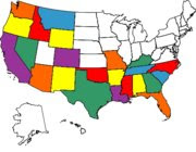
Today's State - Louisiana: Pelican State

Not all who wander are lost.

Saturday, February 13, 2010

Picture Stitching

Alpine, Texas

Weather: low 30 degrees, high 58 degrees, clear skies, light breezes

After the great adventure to Big Bend yesterday, we needed some down time to rest. About the only things I did of consequence was to go for a walk and took the laundry to wash it while Carolyn did her thing on cleaning the RV. Whenever she gets started with that, I try to find something to do that keeps me out of her way.

Our digital camera has the stitch application, where I can take pictures in a panoramic type of sequence. Then, the edit program will stitch the pictures together so a series of pictures will be added together seamlessly. That allows a larger picture to be taken, giving a better idea (hopefully) of what we see in our adventures. I've learned how to use the stitch program, and the pictures have turned out great. Only one problem: the blog program trims the pictures down so much that I still lose the scale I'm trying to share. I'll keep trying. Anyway, here's my first effort, and from a distance, it shows the Chisos Mountains in Big Bend National Park.


With all the talk about being environmentally friendly and using resources in a green
manner, I noticed that the folks here in southwest Texas are way ahead of most of the country in saving energy. Not to speak of money. This wind mill is typical of many that we see on farms and ranches. What's surprising to us is how many homes have them, pumping water to a large holding tank. In addition, many of the houses have a rain collection system, where the rainfall is directed from the roof to holding tanks for use as needed. There are many houses that use the sun to heat water, as well as solar panels that provide some or all of their electricity. To top all these energy saving devices off, a lot of people use solar clothes dryers (also known as clothes lines). Of course, it helps that they live in a part of the country that has abundant sunshine, even in the winter.

Okay, enough of that.


How would you like to stumble into something like this? The desert is full of plants with thorns and stickers. Even though we've not seen much of it, we know there is a lot of animal, bird, reptile, and insect life here.

We've enjoyed our time here, but it looks like we'll be leaving on Monday, starting a circle back toward the coast.

More later, be safe.

Today's Town - Umatilla, Florida: Gateway To The Ocala National Forest

Not all who wander are lost.

Friday, February 12, 2010

Road Trip To Big Bend

Alpine, Texas

Weather: low 29 degrees, high 58 degrees, clear skies, light breezes

The weather was so nice today that we decided to go down to the west entrance of Big Bend National Park and tour the parts of the park we had not seen yet. So, getting an early start, we were on the road by 0900 hours. It may not seem early to some folks, but believe me, since I'm not working, that's an early start for us.

The west entrance to the park is about 80 miles from Alpine, but the road goes through some beautiful countryside with few people living there. That meant very little traffic.

After about 60 minutes of driving time, we started seeing scattered places where people were living. RVs, mobile homes, small houses, and other types of buildings being used for people to live in. Many of them appeared to be vacant. We've wondered what brings people here to live in a place that is so far from the conveniences that most of us take for granted, and to us the attraction is the weather in the winter and the natural beauty of the area. We think that everything probably changes in the summer, when the heat is probably oppressive.

Before getting to the park entrance, we drove through the small towns of Study Butte and Terlingua. Put an emphasis on small. Not much there at all, even though there appears to be a new school.

Since we had seen much of the eastern part of the park last week, our emphasis on this visit was to go to the Castelon Visitor Center, located a short distance from the Rio Grande River and the US/Mexico border. Obviously, we took this picture from the US side. There's not much there to stop illegal aliens from crossing the river, with most places we saw shallow enough to wade across.

That's footprints on the other side of the river.

The Castolon Visitor's Center was first used by the US Army to patrol and protect the area from bandits until about 1920, when conditions in Mexico stabilized. People from the two countries moved back and forth across the border with little or no interference until the events of 9/11 caused the US to close the border. As a result, the little Mexican town across the river has almost died.

The next stop after Castolon was at the Santa Elana Canyon overlook. The canyon was created by the Rio Grande River over the course of millions of years.

By the time we reached the overlook, it was starting to get late enough that we began to make plans to head home. The big question was which way to go: backtrack the same way we came, or take Old Maverick Road, a gravel road that would help us complete a circle in the park. Carolyn was feeling adventurous today, so she voted for taking the gravel road because it would be about 15 miles shorter in distance. Well, now. Shorter in distance doesn't necessarily mean shorter in time. The gravel road was 14 miles long, and it took us about two hours to drive it because it was so rough. I'm still looking for a filling from one of my teeth. The picture truly does not do justice to how rough the road was.

Eventually, we made it off the graded road and back to civilization in Study Butte. Then it was back home, with a short stop at a Border Patrol checkpoint so they could make sure we were US citizens and weren't carrying any contraband.

There's more to today's adventure, but I'm wore out. I'll finish this adventure tomorrow.

More later, be safe.

Today's Town - Terlingua, Texas: Chili Capital Of Texas

Not all who wander are lost.

Thursday, February 11, 2010

Not So Lazy After All

Alpine, Texas

Weather: low 34 degrees, high 45 degrees, light showers, mostly cloudy skies

Here's a typical fence that we have noticed around homes here in west Texas.

We have found that we can't see a place to it's fullest potential when the weather is like it was today. So, we used the day as an excuse to do a bunch of nothing. Except for.... Wait a minute. Now that I think about it, it wasn't such a slow day after all.

I went for a long walk in between the light showers that came and went all day. The showers were such that I would have had to stand out in it all day to get wet. After the walk, we went to the public library used book store to check out their selections. With about 20 minutes searching, we found 12 books we haven't read. That helped us stock up again.

Carolyn was looking for some craft materials, so we stopped at a couple of stores. The first one didn't have what she wanted, but the second one did, and she was pleased with what she found.

Once I had Carolyn back home, I went to Sul Ross State University to donate blood. There seems to be a real shortage of blood, especially O negative and O positive. It was good to see the response of the university and community to the plea for blood. I had to wait about 45 minutes before I could make a deposit, but that was fine.

When my blood letting was finished, I stopped at the Museum of the Big Bend, located on the university campus. I really didn't know what to expect, but was pleasantly surprised at the quality of the exhibits. As expected, the museum concentrated on the history of the Big Bend area, the people who played such an important part in the development of the area, the geology, and the animal life. If any readers are in the area, the museum is well worth a couple of hours.

When I was back at home, I has another chore to take care of. Over the last couple of weeks, we have had a slow leak in one of the RV tires. Unfortunately, we haven't found a place to get it repaired until today. There is a shop here that can do the job when we get ready to leave. In the meantime, the tire had leaked down a little, so I used our air compressor to pump the tire back up to 80 pounds. I'll check it in a couple of days and thereafter until we get ready to leave here. Then we'll get the repair done.

So, I guess it wasn't such a lazy day after all.

More later, be safe.

Today's Town - Boulder City, Nevada: Home Of Hoover Dam

Not all who wander are lost.

Wednesday, February 10, 2010

Fort Davis, Texas

Alpine, Texas

Weather: low 31 degrees, high 45 degrees, cloudy

We were expecting a little snow, but it looks as though it has passed us by. Drat! I know the folks up north have gotten more than enough this winter, but we would like to have seen a little. Plus, it aggravates the grandkids when we get snow and they don't.

Yesterday, we took a short drive of about 25 miles north to Fort Davis, located (where else) in the Davis Mountains. I seem to be able to home in on the nice old courthouses, so here's the one for Jeff Davis County. It was built in 1910, and is designed in the Classical Revival style. I don't know much about styles, but I know what I like, and this one is nice.

Can you guess who the county is named for? That's right, Jefferson Davis, the president of the Confederacy. Before he was the president of the Confederacy, he was the US Secretary Of War before the Civil War.

Fort Davis is a small town of about 1,000 people, while the county only has about 2,500 people. Not thickly settled at all. Tourism is important to the economy, and there are several natural attractions in the area that draw people. The beauty of the mountains, the climate is cooler in the summer with an altitude of about 5,100 feet, Davis Mountains State park, and McDonald Observatory, operated by the University of Texas and located a few miles away, all combine to create a great place to visit. This picture of the observatory was found on their website. I hope to have some that I take of the observatory in the next few days.

It was fascinating to drive through the side streets of Fort Davis and suddenly realize that most of the streets are not paved. In this day when it seems the entire world is becoming one continuous piece of concrete, we happen upon a little town that bucks the trend.

When we sere finished in the little town, we drove on through town about a half mile to the site of Fort Davis National Historic Monument. The old fort was placed here in 1854 and served to protect the area from Indians and bandits until 1891. It was named after Jefferson Davis (I wonder if he named it?) while he was still the Secretary of War for the US. The old fort is probably one of the best remaining examples of what the forts in the west were like. The following are some of the pictures I took while there. Note the terrain.

This is one of the enlisted men's barracks.


This is the post hospital. As I was looking at some of the tools the doctors used, I was glad that medical care is so much better now. Although, if you listen to some of the talk out of Washington, they would have us believe that we have a third world medical system in the US.


This is the commanding officer's house. It was furnished nicer than I thought it would be.


When the fort was at it's busiest, it had over 100 buildings. Today, there are 24 buildings that have been refurbished, with foundations and ruins of about 50 still visible. An interesting side note: This fort was manned by the famous Buffalo Soldiers.

More later, be safe.

Today's Town - Indianola, Mississippi: I-Town

Not all who wander are lost.

Tuesday, February 9, 2010

The Marfa Lights

Alpine, Texas

Weather: low 28 degrees, high 45 degrees, cloudy with some sleet until about noon, then clear skies

Today is a special day. Our youngest daughter Lori was born several years ago (can't say too much so I don't give her age). Happy Birthday, Dear!

Did you see what I wrote about the weather? Sleet? I didn't know there was enough moisture in the the air for sleet. The forecast is calling for a mix of rain and snow tomorrow. That should be interesting.

As I mentioned in yesterday's post, we were going to Marfa last night to see the famous Marfa Lights. The sunset was so beautiful, I had to get a picture to share. Before we went to the Marfa Lights viewing area, we drove into Marfa to check out the little town. It has a population of about 2,100 people, and is the county seat of Presidio County. The town was established back in the 1880s as a watering stop for the railroad.

It amazes us that some of the places that we go to have some of the smallest populations, yet have some of the most beautiful and well-maintained public buildings, such as the county courthouse in Marfa.

We didn't know it, but it seems that Marfa has been the location for several movies being filmed over the years. Examples include "No Country For Old Men", and "There Will Be Blood". The most famous movie filmed there starred Elizabeth Taylor, Rock Hudson, James Dean, Sal Mineo, Carroll Baker, and Dennis Hopper. Care to guess the title of the movie? I wouldn't have known, either, but the title of the movie these big stars were in was "Giant". The stars for "Giant" stayed in The Paisano Hotel, located just off the courthouse square.

By the time we finished in Marfa, it was close to dark. Presidio County has erected a viewing area for the lights just east of Marfa on US 67, near an old Army air base that dates back to World War II. We had been advised earlier to dress warmly, since the desert tends to cool off rapidly at night. Well, we were dressed in a way that we though was going to be warm (three layers including a heavy jacket, gloves, and hats). It wasn't enough, as the wind was blowing about 25 mph. It was cold!!!

Eventually, it was dark enough that the stars began appearing. And, I have to tell you that star gazing here could be world class. There are so many to see, and I hadn't seen stars like this since I was much younger.

Since this was our first time to see the lights, we didn't know what to look for. Suddenly, we saw lights start appearing that didn't seem to have any origin that we could see. Most of them were well above the ground, and lasted for a second or two, with some lasting longer. Some of them were just flashes that we caught out of the corners of our eyes.

What was our impression? An interesting phenomenon that we're glad we saw. Many people have tried to explain what causes the lights, but so far, no one seems to have found a satisfactory explanation. They have been appearing since about 1883, and show no sign of going away. We're glad we went to see them, but would have liked to stay longer to view them. It was just too cold to spend a lot of time there. Maybe we'll be back someday when the weather is warmer, and can spend more time watching the famous lights of Marfa.

More later, be safe.

Today's Town - Alpine, Texas: In The Alps Of Texas

Not all who wander are lost.